
Why Google Maps Is The Ideal Trip Companion
Travelling can be fun, but at the same time, it can be stressful and overwhelming, especially when you’re in an unfamiliar place. The good news is that technology has you covered and in some cases it’s free!
One of these cases is Google Maps, an excellent free app that will not only provide you with directions, but it will also give you access to a community of users who are constantly posting updates in the form of reviews, photos, and videos and even making sure that information is accurate.
I tend to travel a lot for work and leisure and I use many useful travel apps on my phone, but Google Maps is the one app that I always keep on my phone and never delete. I mean, it has definitely got me out of a few sticky situations!
That’s why in this blog post, I will share the ways I use Google Maps to help navigate new places and not only.
Use it to Plan Trips Using Public Transport
In the past, I always used Google Maps to plan trips using public transport. Not only did the app take me to the bus stop I needed, but it told me which service I need to catch and it would take me where ever I needed to go.
It wasn’t until my trip to Budapest in Hungary last year that I found out the full potential of the app, and it was pretty impressive!
Throughout the trip, I relied on public transport to get me around the city, but I didn’t really know where I was going so naturally, I decided to use Google Maps to help me out.
Not only did the app take me to the stops I needed, but it also recommended the best ways of getting there using public transport.
During the trip, the app would ask me questions like whether the tram or bus was busy or not and whether their air conditioning was functioning on that service, which I just couldn’t say no to. It also warned me when my stop was approaching so that I didn’t miss it.
I find that it’s the little things like this that prove to be extremely helpful, especially to someone who was visiting the country for the very first time.
The best part is that this also works at home, the only downside is that you have to start a trip on your phone to get questions like is the service busy or not, which I think is a shame. It would be great if there was an easier way to gain access to this sort of thing as it’s extremely helpful!
Find New Places
One of my favourite things about Google Maps is the fact that people can leave reviews, photos and even videos of places, which really helps others when searching for new places.
A great example of where this can be useful is food, you can use it to find great local food that even the locals recommend. Depending on the restaurant or cafe, some locations even have extra features. For example, it can tell you how long the wait is and some restaurants also allow you to book reservations without leaving the app!
Some restaurants even have an area that tells you what the most popular dishes are and they also show the menus!
However, the one thing I would advise with reviews is to treat them with a pinch of salt, especially when all reviews are good and look genuine but there’s that one awful review.
You can also use Google Maps to discover other places such as points of interest or use it to find activities. During my trip to Budapest, we discovered the Palatinus Strand Baths with the help of Google Maps which turned out a be a great place to just chill during a warm summer’s day.
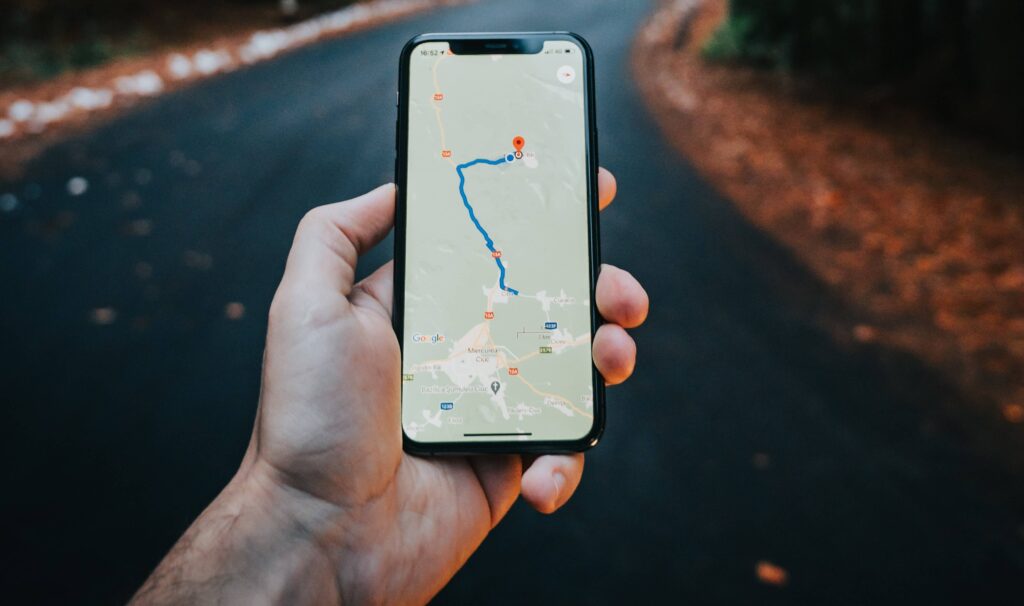
Use it for Directions!
Let’s not forget about one of the main features that Google Maps provides, the ability to show you directions for several modes of transport including car, cycling, walking and public transport!
When it comes to public transport, so far I discovered that it covers buses, coaches and various forms of trains such as trams and underground trains.
I tend to use Google Maps in my everyday life both as a Local Guide and as a general user who is looking for the best way of getting from point A to B. One of the ways that this is useful is that it helps to determine the fastest route that avoids traffic.
I found this feature particularly useful when I was running late for work, I simply got the maps out and was able to find the fastest route into the office, and yes I arrived on time thanks to Google Maps.
When going on Cycling Trips I use Google Maps to plan out my cycling routes it helps me make sure I have enough time and find interesting places to visit on the way. The app even tells me how flat the surface is!
Final Thoughts
In summary, Google Maps is an absolutely brilliant app that I honestly can’t recommend enough and the best part is that it’s compatible with Android, iOS and even the web!
The app has got me out of many situations over the years such as getting lost in the Polish countryside and knowing how to get to places I’ve never been to before. It has also proven to be useful in everyday life with just finding the best routes to get to places I already know how to get to.
If you’ve ever used Google Maps to get you out of a sticky situation, share your story in the comments!
Discover more from TECH WITH DOM
Subscribe to get the latest posts sent to your email.